Hogyan jelölhetünk ki célokat és javíthatjuk a képzést?
május 09, 2026
A által Simon Samodurov
Ebben a kutatási cikkben a DTU értékeli a kereskedelmi forgalomban kapható (COTS) nyomkövető címkéket a drónok kiképzésében és harcában való felhasználásra. A tanulmány összehasonlítja a Bluetooth-alapú eszközöket, például az Apple AirTageket, a Tile Pro-t, a Samsung SmartTageket és a dedikált mikro-GPS nyomkövetőket az ukrán hadsereg First-Person View (FPV) és a standard quadcopter műveletek szempontjából kritikus mérőszámokkal.
A Bluetooth Low Energy (BLE) címkék működése
Ahelyett, hogy közvetlenül a műholdakkal vagy a mobiltornyokkal kommunikálna, a Bluetooth Low Energy (BLE) egyszerű, kis teljesítményű rádiós jeladóként működik. A 2,4 GHz-es frekvenciasávban folyamatosan egyedi, titkosított azonosítót sugároz. Mivel csak rövid, időszakos adatszakadásokat sugároz, ahelyett, hogy aktív, nehéz kétirányú kapcsolatot tartana fenn, a címkék akár egy évig is működhetnek egyetlen óraelemmel. Ez a kis súly és a minimális energiaigény teszi őket rendkívül alkalmassá a kis pilóta nélküli légi rendszerekről (sUAS) történő eldobható telepítésre.
A BLE-címkék kétféleképpen működnek: anonim hálózati feltöltéssel bármely közeli mobiltelefonról, illetve közvetlen, rövid hatótávolságú kommunikációval a vezérlő mobiltelefon(ok)kal. Mivel mind a kiképzési, mind a harci környezetben nem valószínű, hogy a közelben hálózatba kapcsolt mobiltelefonok vannak, az ukrán hadsereg a címkéket többnyire közvetlenül, azaz legfeljebb 150 m-es érzékelési távolságon belül használja majd.
Az üzemeltetők speciális alkalmazásokat, kézi RF-szkennereket vagy drónra szerelt mikrokontrollereket használhatnak a 2,4 GHz-es adás jelerősségének mérésére. Ahogy a vevő közelebb kerül a címkéhez, a jel erősödik, lehetővé téve az operátorok számára a pontos helymeghatározást még sűrű lombok vagy összetett törmelék között is. Ezenkívül sok címke rendelkezik beépített piezoelektromos hangszórókkal, amelyek nagydecibeles riasztást adnak ki, így a keresés utolsó méterein egy utolsó hangjelzést adnak a lezuhant kiképzőeszköz pontos helyének meghatározásához.
Figyelmeztetések a címkék használatakor
Amikor a címkéket olyan nagy intenzitású elektronikus hadviselési (EW) környezetben használják, mint Kelet-Ukrajna, a katonáknak komoly műveleti biztonsági (OPSEC) kockázatokkal kell megbirkózniuk. Ezeket a polgári eszközöket elveszett kulcsok felkutatására tervezték, nem pedig taktikai használatra a modern harctér sűrű érzékelőhálózatában. A nyomkövető címkék használata jelentős kockázatot rejt magában az ellenséges erők általi észlelés, illetve a baráti erők általi véletlen felfedezés és az orosz kémeszközökként való téves azonosítás szempontjából.
A következő kritikus figyelmeztetések erősen ajánlott ezeknek a nagy teljesítményű, de veszélyes nyomkövető eszközöknek a taktikai környezetben történő használata esetén.
- Ne légy “világítótorony” A kereskedelmi forgalomban kapható BLE-címkék folyamatosan sugároznak egy jeladót a 2,4 GHz-es frekvenciasávon. Ez a kis teljesítményű, de a katonai szintű hírszerzés (SIGINT) számára jól látható sugárzás. Az orosz elektronikai hadviseléssel foglalkozó egységek fejlett észlelőrendszereket üzemeltetnek (például a Leer-3, a Zhitel és az újabb speciális UAS-érzékelők, mint a Filin-I), amelyek folyamatosan keresik az elektromágneses spektrum anomáliáit. Egy aktív BLE-címke viselése a személyén lényegében egy két lábon járó rádiójelzővé változtatja a katonát, lehetővé téve az ellenséges EW számára, hogy háromszögelje a helyzetét még akkor is, ha az elsődleges rádiója és okostelefonja ki van kapcsolva.
Megoldás: Mindig kapcsolja ki a címkéket, lehetőleg az elemek eltávolításával, amikor nem használja őket.
2. Értesítések ellenséges eszközöknek Ha egy ukrán drón AirTag vagy SmartTag-et dob egy orosz lövészárokba vagy járműre, hogy nyomon kövesse azt, a címke végül felismeri, hogy távolodik a tulajdonosától. Ekkor automatikusan értesítést fog küldeni (pl, “Egy AirTag veled mozog”) a közelben tartózkodó orosz katonák okostelefonjaira. Ez a polgári biztonsági funkció gyakorlatilag korai figyelmeztető rendszerként működik az ellenség számára, elszállítva a meglepetés erejét. Ezenkívül a kereskedelmi címkék úgy vannak programozva, hogy hangos hangjelzést adjanak ki, amikor elválasztják őket a
párosított okostelefon hosszabb ideig (általában 8 és 24 óra között, márkától és firmware-től függően). Ha a címkét rejtett rejtekhely, drónkilövőhely megjelölésére használják, vagy egyszerűen csak a hátizsákban felejtik, előfordulhat, hogy önállóan csipogni kezd.
Megoldás: Állítsa be a célmegjelölő címke beállításait úgy, hogy ne kommunikáljon a közeli eszközökkel. A kiképző nyomkövetők beállíthatók úgy, hogy egy meghatározott intervallum után, amikor nem lépnek kapcsolatba a tulajdonos telefonjával, automatikusan zajt adjanak ki, így a drónt könnyebb megtalálni. Minden olyan helyreállítási műveletet, amely az okostelefonokra támaszkodva követi a címkét, szigorúan a hátsó sorból vagy a követő drónokra szerelt automatizált mikrovezérlőkön keresztül kell végrehajtani, így az emberi kezelőket offline és az EW célkeresztjén kívül kell tartani.
Címkék használata drón célpontok felderítéséhez
![]()
Az olcsó, kereskedelmi forgalomban kapható nyomkövető címkék egyik felhasználási módja az, hogy - jellemzően egy ISR drónról - ellenséges állások közelébe vagy azokra dobják le őket, hogy megkönnyítsék az utánuk következő csapásmérő drónok számára a célpont megtalálását.
Legjobb lehetőségek:
- Leghosszabb olcsó hatótávolság: Tile Pro (Life360) - 170m hatótávolság
- Nagyobb hatótávolság esetén: 15 km-es hatótávolság: Fejlett LoRa nyomkövető - 15 km-es hatótávolság
A csempekövetők észlelését a követő támadó drón fedélzetén kell elvégezni, amihez vagy egy mobiltelefont, vagy - ami sokkal olcsóbb és könnyebb - egy önálló Bluetooth Low Energy (BLE) leolvasó eszközt kell használni. A letapogató eszközök az $1000 multiméterek, a dedikált BLE nyomkövető eszközök és poloskaszkennerek az $15-hez ESP32 fejlesztői lapok beépített Wi-Fi-vel és Bluetooth-szal, amelyek ideálisak drónokba való integrálásra, hogy automatizált BLE szimatolóként működjenek. Példák: Espressif ESP32 fejlesztői kártya, M5Stack ESP32 fejlesztői készletek
Taktikai felhasználási megfontolások
- Iránykövetés: Az irányított követéshez AoA (Angle of Arrival) hardverre (több antennára) van szükség, ami bonyolultabbá teszi a drón hasznos terhelését, vagy a csapásmérő drón repülésirányítójának egyedi szoftverre lenne szüksége ahhoz, hogy egy keresési mintát (például spirál) repüljön, hogy folyamatosan mérje, hogy a jel erősödik vagy gyengül-e a jel.
- 2,4 GHz-es jeltorlódás: A 2,4 GHz-es spektrum erősen túlterhelt. A drónra szerelt BLE szimatolónak át kell szűrnie a baráti drónok, az ellenséges drónok, a közeli romok Wi-Fi routerének és a helyi EW zavarás jeleit. A szimatolót szigorúan úgy kell programozni, hogy az elejtett címkéhez rendelt MAC-cím kivételével minden MAC-címet figyelmen kívül hagyjon, hogy ne térjen le az útvonalról.
Látótávolsági korlátozások: A becsült hatótávolság minden eszköz esetében ideális látótávolságot feltételez (pl. dróntól drónig). Ha egy címkét mély árokvonalba, betonbunkerbe vagy sűrű lombozatba dobnak le, a földi zavarok drasztikusan csökkentik a hatótávolságot.
Környezeti és fizikai realitások
- Ütközés túlélőképessége: A kereskedelmi címkéket úgy tervezték, hogy a konyha padlójára dobják le őket, nem pedig egy 100 méter magasan lebegő ISR drónról. A Tile vagy SmartTag műanyag burkolata és belső akkumulátorának érintkezői valószínűleg összetörnek vagy szétkapcsolódnak, ha kemény talajra ütköznek. A címkékhez egyedi 3D-nyomtatású, ütéselnyelő TPU (termoplasztikus poliuretán) tokokra, illetve öntözőanyagra lesz szükség, hogy túléljék a leejtést.
- Jelcsillapítás sárral és vízzel: A víz rendkívül hatékonyan blokkolja a 2,4 GHz-es jeleket. Ha a címkét egy sáros árokba vagy mély hóba dobják - vagy ha rálépnek és betemetik -, a Tile Pro tényleges 170 méteres hatótávolsága azonnal néhány méterre csökkenhet, és elvakítja a bejövő csapásmérő drónt.
- Hideg időjárás akkumulátor meghibásodása: A szabványos kereskedelmi címkék CR2032 lítium elemeket használnak. Az ukrajnai tél fagyos hőmérsékletén ezeknek a civil elemeknek a feszültsége gyorsan lecsökkenhet, és a címkék a terepen történő bevetés után órákon (vagy perceken) belül lemerülhetnek, jóval a csapásmérő drón megérkezése előtt.
Taktikai és ellenséges kockázatok
- A “Honeypot” csapda: Ha az orosz erők felfedezik a ledobott címkét, mielőtt a csapásmérő drón megérkezik, könnyen kihasználhatják a taktikát. Egy ellenséges katona bedobhatja a címkét egy kijelölt gyilkos zónába, vagy egy csalira erősítheti, és így az utána következő csapásmérő drónt közvetlenül koncentrált kézifegyveres vagy helyi EW-tűzbe vonhatja.
- Ellenséges TSCM általi észlelés: Amint azt már korábban említettük, az eldobott címke aktív 2,4 GHz-es pingje látható az ellenséges rádiófrekvenciás szkennerek számára. Az ellenséges pozíció közelében ledobott címke fizikai figyelmeztetésként szolgál arra, hogy egy ISR drón célba vette őket, ami arra késztetheti őket, hogy szétszóródjanak, átálljanak, vagy aktiválják a helyi zavarókat, mielőtt a csapásmérő drón támadásba lendülhetne.
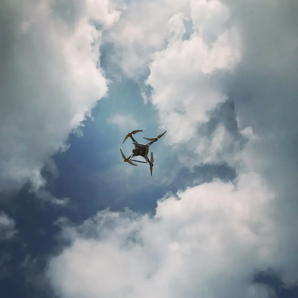
Címkék használata a képzésben
![]()
A drónpilóta-képzés gyors tempójú környezetében a balesetek és az elrepülések a tanulási görbe elkerülhetetlen részét képezik. A gyakorló drónjaikat intenzíven repülő ukrán gyakornokok számára egy drón elvesztése egy kritikus, drága eszköz elvesztését és értékes képzési órák feláldozását jelenti. Az olyan könnyű nyomkövető eszközök, mint az Apple AirTag, közvetlenül a drón alvázára történő integrálása biztosítja, hogy a lezuhant eszközök gyorsan megtalálhatók és visszaszerezhetők legyenek. Ez az egyszerű, alacsony költségű módosítás működőképesen tartja a kiképző flottákat, csökkenti a pótlási költségeket, és maximalizálja azt az időt, amelyet a pilóták a földi keresés helyett a levegőben töltenek képességeik csiszolásával. Mivel a kiképző drónok rendkívül érzékenyek a súlyeloszlásra és a repülési dinamikára, a kutatás során olyan megoldásokat helyeztek előtérbe, amelyek nem változtatják meg a repülőgép teljesítményét, és nem igénylik a drón elsődleges energiaellátásának megcsapolását.
Ajánlott legjobb Opciók
 Az elsődleges ajánlás a Tile Pro (a Tile-on keresztül forgalmazza a Life360). Ez a készülék a jelenleg elérhető legnagyobb hatótávolságú Bluetooth nyomkövető, és erőteljes, 110db-os riasztóval rendelkezik.
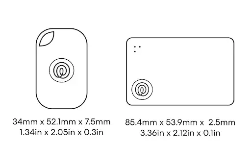
Főbb specifikációk:
- Súly: 12g
- Hatótávolság: 500ft
- Hangerő: 110db
- Az akkumulátor élettartama: 1 év
Míg a Tile Pro a funkciók erős egyensúlyát képviseli, léteznek különböző alternatívák, amelyeknek különálló előnyei és hátrányai vannak. Ezek a gazdaságosabb, rövidebb hatótávolságú Bluetooth-követőktől a jelentősen nagyobb hatótávolságú LoRa (Long Range) nyomkövetőkig terjednek, amelyek jellemzően magasabb árat és nagyobb súlyt jelentenek.
Versenytársak összehasonlítása
Az alábbi táblázat a főbb termékkategóriákat mutatja be, az előnyök és hátrányok rövid áttekintésével:
Premium fogyasztói Bluetooth nyomkövetők:
Tile Pro: A legjobb prémium cross platform Bluetooth opció:
$19 egységenként. Súly: 12g Tartomány: Hangerő 110db, akkumulátor élettartama: 1 év,
Vízállóság: igen. Kevésbé aerodinamikusan kiegyensúlyozott. Méretei szögletesek, és egy kicsit nagyobb, mint más termékek. Viszont a legjobb idézett hatótávolsággal és a leghangosabb riasztással rendelkezik, kiegyensúlyozott súlya mindössze 12 g.
Tile Life 360 - A legjobb egyensúly a költségek és a könnyű használat Bluetooth opció között.
$15 egységenként. Súly: 8g, Hatótávolság: Akkumulátor: 3 év, vízállóság: igen. Legjobb akkumulátor élettartam, legjobb súly, meglehetősen szimmetrikus forma az aerodinamika érdekében.
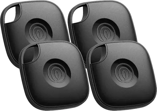
Csempe Variety Pack- $95 három csempekövetési lehetőség teszteléséhez
![]() Megfizethető LoRa Tracker: (Készleten van, de nagyobb súly és nagyobb méret): Költség: $29.00 - $40.00
Megfizethető LoRa Tracker: (Készleten van, de nagyobb súly és nagyobb méret): Költség: $29.00 - $40.00
Ez is igényel némi technikai szakértelmet a beállításhoz, de van benne potenciál, tekintve, hogy ez az egyik egyetlen könnyű, nagyon nagy hatótávolságú nyomkövető a piacon. IP-besorolás IP65 Méretek 85 * 55 * 6,5 mm Eszköz Súly 32g Üzemi hőmérséklet -20 ℃ és +60 ℃ között
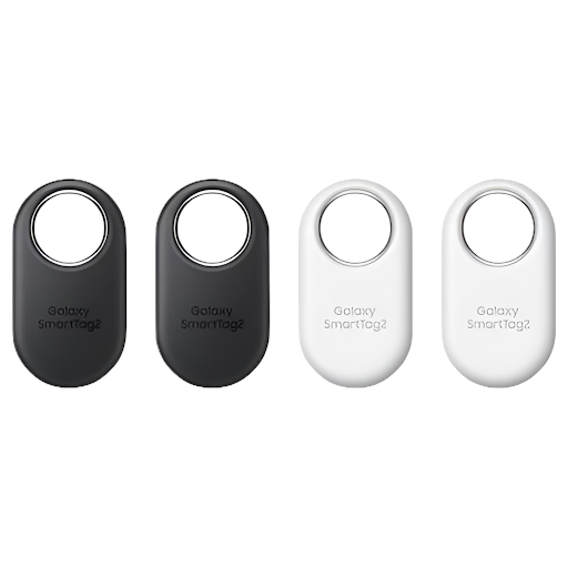 Galaxy SmartTag2 - LINK $15 egységenként. 120m. Ez a hatótávolság egy tipikus felhasználási esetre vonatkozik: nagy beltéri helyiségek, vagy nyílt, akadályok nélküli kültéri helyiségek. A valós teljesítmény a környezettől, a jelet blokkoló domboktól vagy fáktól függően nagymértékben változhat.
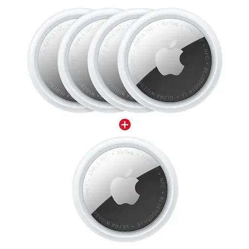
Apple AirTag Gen 2 - A legjobb Apple-hálózati lehetőség. AirTag gen2
Az AirTag Gen 2 megtartja a hasonló formai tényezőt, de javítja a keresőrendszert: 31,9 mm átmérő, 8,0 mm magasság, 11,8 g súly, IP67 vízállóság, Bluetooth közelségkeresés, második generációs ultraszélessávú, beépített hangszóró, és egy cserélhető 1 év akkumulátor. Az újabb modell kibővített Bluetooth hatótávolsággal rendelkezik, Precision Finding akár a 50% tovább mint az előző generáció, és egy olyan hangszóró, ami 50% hangosabb, de ez még mindig a Find My hálózattól függ, nem pedig a független GPS-től. A kör alakú forma feltehetően jobb az aerodinamika szempontjából.
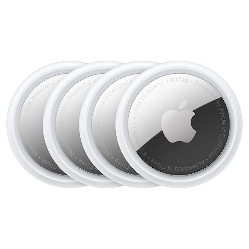
Apple AirTag Gen 1 - Apple-hálózati opció (valamivel rosszabb, mint a gen 2) AirTag gen1
Az AirTag Gen 1 egy könnyű Apple Find My nyomkövető, amely a következőkkel rendelkezik 31,9 mm átmérő, 8,0 mm magasság, 11 g súly, IP67 vízállóság, Bluetooth közelségkeresés, U1 ultra-szélessávú precíziós keresés, beépített hangszóró, és egy cserélhető 1 éves akkumulátor. Hasznos, ha az edzőcsoport iPhone-okat használ, de ez nem egy igazi GPS-nyomkövető; ez attól függ, hogy a közelben lévő Apple-eszközök vagy egy kereső elég közel kerül-e a Bluetooth/Precíziós kereséshez. A kör alakú forma feltehetően jobb az aerodinamika szempontjából.
![]()
Loko Air GPS + LoRa Tracker - A legjobb fejlett offline drónkövető lehetőség. (Nincs készleten az EU-ban)
A Loko Air a legerősebb fejlett opció mert a készüléket mobiltornyok nélküli offline GPS-követésre tervezték. Műszaki adatok: Ez a legjobb megoldás a távoli gyakorlótereken, bár többe kerül és földi vevővel való felszerelést igényel.
![]()
Kínai Bluetooth nyomkövetők - olcsó ömlesztett opció. LINK
Költség: $4.15 kulcstartó nélkül, $5.57 kulcstartóval.
Az általános kínai Bluetooth-nyomkövetők a legolcsóbb megoldás, általában $4-$8 körül egységenként, sok listán egyéves akkumulátor-élettartamot, könnyű súlyt és alapvető Bluetooth-megállapítást állítanak.
A pontos méretek, a súly, a hangszóró hangereje, az alkalmazás minősége, a vízállóság és a hatótávolság azonban eladónként változik, a várható gyakorlati hatótávolság nagyjából 10 m / 30 ft, és a valós teljesítmény sokkal rosszabb lehet fűben, bozótosban, dombokon vagy erdős területeken.
![]()
GPS opció- LINK Tétel Méretek 1.81 x 1.5 x 0.6 hüvelyk
Tétel súlya: 36g vagy 1,26 Uncia, Előfizetést igényel, vízálló borítást igényel, SIM-kártya mellékelve, sokkal jobb hatótávolság, mint a bluetooth nyomkövetők. Mobiltelefonos kapcsolatra / mobilszolgáltatás közelségére van szükség.
Egyéb LoRa nyomkövető, amelynek áramforrásra van szüksége: ($59 egységenként) LINK
Más LoRa Trackerek időszakosan magasabb költséggel lehetnek raktáron ($50-$300 egységenként)
Felhasználási folyamat
Használat hely szerint - A drónok repülési kiképzését legjobban Ukrajna nyugati részén lehet végezni. A kelet-ukrajnai kiképzési repülések gyakran vezetnek drónok elvesztéséhez, mivel gyakori az aknamezőkön való landolás, és az ellenséges erők általi észlelés kockázata sokkal nagyobb.
Csatlakozás a drónhoz - A ragasztószalagot előnyben részesítjük a ragasztóval szemben, hogy a nyomkövető szükség szerint eltávolítható legyen. A szalag nem fedheti el a hangszórót.
Automatikus hangjelzések
A szabványos fogyasztói nyomkövető címkék, beleértve az AirTags, a Galaxy SmartTags és a Tiles címkéket, reaktív eszközöknek készültek, és jelenleg nem kínálnak natív “időzített riasztás” vagy “ütemezett csengetés” funkciót. A hangriasztás célja, hogy manuálisan, egy okostelefonos alkalmazáson keresztül váltson ki, vagy automatikus elkülönítési riasztásokkal aktiválódjon, ha az eszközt a tulajdonosa nélkül mozgatják.
Az időzítő hiánya elsősorban ezen eszközök energiatakarékos felépítésének köszönhető. Az egyéves akkumulátor-élettartam fenntartása érdekében a címkék alacsony energiafogyasztású állapotban maradnak, és csak “várják” a kiváltó jelet, illetve a helymeghatározó pinget. A 110 dB-es riasztás egy adott időpontban történő elindításához szükséges folyamatos belső óra figyelés jelentősen megnövelné az energiafogyasztást.
Azokra az esetekre, amikor időzített vagy automatizált jelzésre van szükség a terepi helyreállításhoz vagy a képzéshez, alternatív megközelítések is léteznek:
- Szétválasztási riasztások: Bár nem egy órán alapul, a legtöbb címke “Értesítés, ha hátrahagyják” funkciót kínál. Ez értesítést küld a telefonjára, és a címke csengetni kezd, amint egy bizonyos távolságot elér a párosított eszköztől. Ez nem időbeli, hanem közelség-alapú kiváltószerkezetként működik.
- Automatizálási korlátozások: Az Apple és a Google “Find My” ökoszisztémáinak jelenlegi biztonsági protokolljai általában megakadályozzák, hogy harmadik fél automatizálási alkalmazásai (például az IFTTT vagy a Shortcuts) programozottan aktiválják a “Hang lejátszása” funkciót. Ez egy adatvédelmi intézkedés, amely megakadályozza, hogy a címkéket mások zaklatására vagy nyomon követésére használják az automatizált zajok révén.
- Autonóm helyreállítási riasztók: A drónok és a terepi műveletek során speciális autonóm zúgók használhatók. Ezek az eszközök függetlenek a Bluetooth-hálózattól, és úgy vannak kialakítva, hogy egy meghatározott inaktivitási időszak után vagy áramkimaradáskor nagydecibeles (gyakran 100dB-110dB) riasztást indítsanak, így biztosítva, hogy az eszköz akkor is megtalálható legyen, ha nincs a közelben telefon, amely elindíthatná. Aktív riasztás. Videó magyarázat
Terepi használatra, ahol a térfogat a döntő tényező, a Tile Pro 110dB kimenete miatt továbbra is vezető opció, bár továbbra is kézi indítást igényel az alkalmazásból, amint a kereső az 500 lábas Bluetooth sugarú körön belül van.
Függelék: A követelmények
Az értékelési ellenőrző lista a következő kritériumokat tartalmazza:
- Súly és aerodinamikai hatás
- Alapsúly: Milyen nehéz a készülék a dobozból kivéve? A mozgékony FPV elfogók vagy a standard DJI Mavics esetében már 10-15 gramm plusz is megváltoztathatja a repülés dinamikáját és csökkentheti az akkumulátor hatékonyságát.
- Csupaszított súly: Könnyen csökkenthető a nyomkövető a felesleges grammok lefaragása érdekében?
- Súlypont: A nyomkövető formája lehetővé teszi, hogy középre szereljék, vagy a tömege megzavarja a drón aerodinamikai egyensúlyát?
- Hatótávolság és jelarchitektúra
- Hálózati függőség: A nyomkövető egy Bluetooth mesh hálózatra támaszkodik (mint az Apple “Find My” vagy a Tile hálózata), amely a közelben lévő okostelefonokat igényli, vagy önálló micro-GPS/LoRa jeleket használ?
- Vidéki hatékonyság: A gyakorlóterek gyakran távoli területeken vagy sűrű erdőkben találhatók. Hogyan teljesít a jel, ha kilométerekre van a városi mobil- és Bluetooth-sűrűségtől?
- Költségek és beszerzés skálázhatósága
- Egységköltség vs. tömeges rendelés: A szervezet olcsón be tudja szerezni ezeket a nyomkövetőket 50, 100 vagy 500 darabos tételekben?
- Előfizetési díjak: Vannak-e rejtett, ismétlődő szoftverköltségek a nyomkövető hálózat használatához, vagy egyszeri hardverbeszerzésről van szó?
- Könnyű módosítás és szerelés
- Szerszámozási követelmények: A nyomkövető műanyag háza könnyen módosítható, lekerekíthető vagy levágható a szokásos asztali szerszámokkal, mint a Dremel, a csiszológép vagy a bádogvágó olló, anélkül, hogy a belső áramköri lap megsérülne?
- Szerelési kompatibilitás: Könnyen rögzíthető zip-kötegelővel, VHB szalaggal vagy egyedi 3D nyomtatott TPU rögzítővel anélkül, hogy zavarja a drón saját RF antennáit vagy belső elektronikáját?
- Auditív és vizuális helymeghatározási segédletek
- Csengetési decibel kimenet: Elég hangos a beépített hangszóró ahhoz, hogy a nagy szélben is hallható legyen, vagy amikor a drónt sűrű bozót és lombkorona törmelék alá temetik?
- Kioldó mechanizmus: A riasztás manuálisan, okostelefonos alkalmazáson keresztül is elindítható abban a pillanatban, amikor a pilóta elveszíti a videókapcsolatot?
- Energiaforrás és termikus ellenálló képesség
- Akkumulátor függetlenség: Független, könnyen cserélhető akkumulátorral működik (mint egy CR2032), vagy a drón elsődleges LiPo akkumulátorából kell áramot venni (amely kilökődhet vagy meghalhat egy ütközés során)?
Hideg időjárási teljesítmény: Milyen gyorsan romlik a nyomkövető akkumulátora a kelet-európai edzési környezetre jellemző fagyos téli hőmérsékleten?
Kutatási linkek
- Life360 / Tile modell specifikációi
- Apple AirTag Gen 1 műszaki adatok
- Apple AirTag Gen 2 műszaki adatok
- Samsung Galaxy SmartTag2 specifikációk
- Seeed Studio Loko Air GPS + LoRa nyomkövető (Magasabb költség, de a készlet ma elérhető)
- OpenELAB Loko Air GPS + LoRa specifikációk
- Tracki GPS/celluláris nyomkövető
A LoRa technológia és a felhasználási esetek technikai áttekintése
- Semtech: Mi az a LoRa?
- A Semtech LoRa technológia áttekintése
- Semtech: LoRa és LoRaWAN műszaki áttekintés PDF
- Eszközök nyomon követése LoRaWAN használatával: kísérletek a hatékony hatótávolságra és a jelbefogásra vonatkozóan
- A LoRa lokalizációs technológiák áttekintése
- Alacsony költségű LoRa GNSS nyomkövető a vadvilág megfigyeléséhez
- LoRaWAN földrajzi nyomkövetés térképillesztés és iránytűér-érzékelő fúziója segítségével